IFC
Use this dialog to define the project base point for the BIM project, i.e., the map coordinates that the IFC origin corresponds to, and to control how Gemini Terrain exports data to IFC.
Where do I find the dialog?
On the toolbar select the icon for Settings Gemini Terrain - Project - IFC.
Map coordinates for the base point in the BIM project
The project base point is the map coordinate that the IFC origin (0,0,0) corresponds to. The program uses it both when inserting and when exporting IFC files.
| Field | Description |
|---|---|
| East | EAST coordinate of the project base point. |
| North | NORTH coordinate of the project base point. |
| Height | Height of the project base point. |
You can enter the values manually, or pick them from the map with Pick. Note that 3D snapping must be active for height to be included (toolbar at the bottom left).
Inserting IFC models
The program uses the project base point when inserting IFC files that are defined relative to an IFC origin. Before you insert the IFC model with Add you must therefore enter the project base point in Settings Gemini Terrain - Project - General to ensure correct placement (otherwise, it may be placed relative to 0,0).
Note
If the IFC origin is not specified, the origin for all terrain models is used. Normally, this is 0,0 and has no significance.
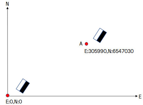
A = Project base point
IFC models with only an internal origin in the model must be placed manually with dynamic placement, or georeferenced with the function Georeference model... that you find on the context menu of models.
Info
See Georeference model for a more detailed description of georeferencing.
Georeferenced IFC models
When you insert a georeferenced IFC model, a dialog appears with the georeference information (IfcProjectedCRS and IfcMapConversion):
- IfcProjectedCRS.Name = EPSG code (specifies the combination of geodetic datum, projection, and height datum)
- IfcMapConversion.Eastings = EAST coordinate
- IfcMapConversion.Northings = NORTH coordinate
- IfcMapConversion.OrthogonalHeight = HEIGHT
The project base point in Settings Gemini Terrain - Project - General is not used if the IFC model is georeferenced. The file will then be placed according to the georeference information, where IfcMapConversion can be 0,0,0 or have a project base point.
Export to IFC
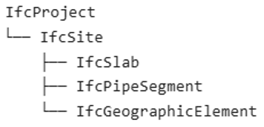
The settings below are used when you export data with File - Export - IFC. The export creates one IfcProject and one IfcSite, and places the elements directly under the site:
Info
You can read more about how application layers and attributes are mapped to IFC in the user manual.
Name of project and construction site
| Field | Description |
|---|---|
| Name of exported project (IfcProject) | The name used for IfcProject in the export file. If the field is blank, the program uses the project name and description from the general properties dialog. |
| Name of exported construction site (IfcSite) | The name used for IfcSite in the export file. Gemini-map is the default name (for backward compatibility). |
Coordinates and content in the export file
The values for the project base point are subtracted from the object coordinates when exporting to IFC. Without a defined IFC origin (0,0,0), you get map coordinates in the file.
| Option | Description |
|---|---|
| Export map coordinates | Writes map coordinates in the file even when the project base point is defined. Off by default. |
| Export inserted IFC files | Includes IFC models that are inserted in the project, in addition to the Gemini data. Off by default. |
Attributes and property sets
You can also configure how different attributes from the schema should be exported, and which property sets they end up in.
| Option | Description |
|---|---|
| Export description as part of the attribute values | Adds the description to the value itself during export. See the explanation below. |
| Export application layer geometry with PSet name | Includes geometry attributes from the application layer, for example Length, Area, and Volume. The default name is Ter_Qto_Geometry. |
| Export attributes at root level with PSet name | Includes attributes at root level, that is, attributes that do not belong to a group in the schema. The default name is Attributter. |
| Export attributes at group level with PSet prefix | Includes the groups in the schema. The prefix is placed in front of the name of the PSet groups, and can be empty (default). |
Names and prefixes are used to avoid name conflicts with standard IFC PSet.
Note
PSet stands for Property Set in IFC and is used to organize properties in logical groups.
About description as part of the attribute values
Normally, descriptions for attribute values (such as S_FCODE) are placed in a description/specification field separate from the actual value. However, most IFC viewers ignore the description field and only show the user the code. With this option, you can decide whether the description should be added to the value during export.
Contract post number
Warning
This function is disabled from version 19.0.1.
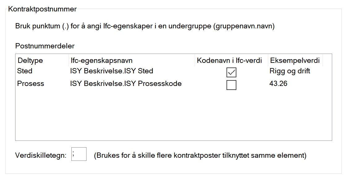
Use these settings to link relevant parts of the contract with attributes as they appear in Gemini Terrain, to display relevant contract posts in Gemini 3D Field. In the example, the fields Location and Process must be filled in, but this will vary between contracts. The program will prompt for the relevant post number parts.
Example
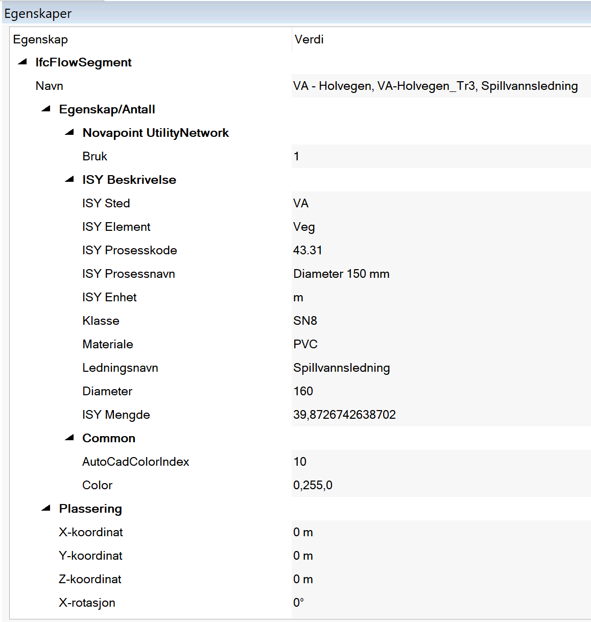
The example below shows how such a link can look. Here, we want to extract ISY Location and ISY Process code. Since these are under the property ISY Description you must use the syntax shown in the second image.
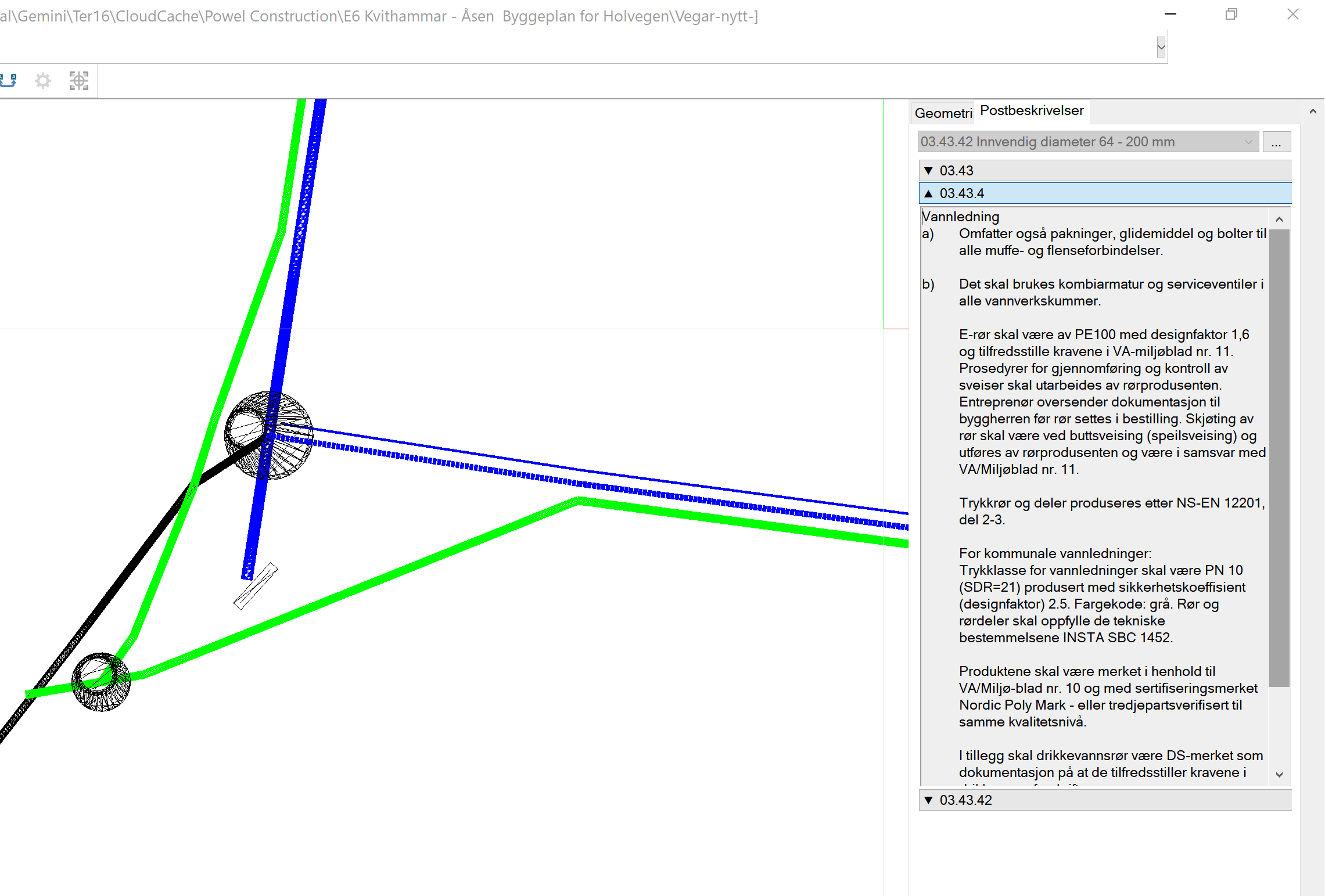
The result in Gemini 3D Field is that the contract appears as a separate tab for IFC elements:
Note
The method described also works for DWG files.