Introduction
Gemini TunnelShape is an add-on module to Gemini Terrain+ for planning, mass calculation, and documentation of scanned tunnels. For tunnel design we refer to a separate chapter.
This section covers mass calculation and documentation.
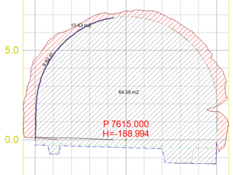
Tunnel cross-section
When we need to document masses in tunnels, we can use the following procedure:
Procedure
- Import measured data
- Import road and tunnel data
- Filter and edit measured data (used to limit the number of points)
- Triangulate points against lines
- Generate cross-sections
- Build theoretical tunnel
- Calculate masses (volume/area)
- Document any deviations
- Produce engineering drawings
Import of scanned data is handled using standard scanning formats such as LAS and Leica pts. We can also set up a general user-defined XYZ format or use KOF.
For triangulation of scan data, we have two methods:
- Triangulation along line (Gemini Terrain+)
- 3D triangulation (SurfaceMaker)
Import/export of theoretical tunnel profiles is covered for Bever, Novapoint, Leica, and Atlas. Typical exchange formats are IREDES, LandXML, and ViaNova XML.
The theoretical and measured data can be visualized using 3D rendering functions in the program.
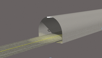
3D view of tunnel blasting profile
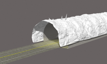
3D visualization of scanned tunnel data
See example collection for implementation: