Combine Triangulated Networks
Use this dialog to calculate intersections between triangulated networks.
Where can I find the dialog?
On the toolbox, select the Combine Triangulated Networks... icon.
Using the dialog
The result can be:
- Volume
- Area
- Combined surface
When you define a calculation, the procedure is the same, but the available options vary depending on the calculation method you choose.
Below is the procedure for Volume.
Procedure
- Select Calculate Quantities from Triangulated Network... in the toolbox.
- Select the calculation method Volume.
- Optionally, select a restriction layer (triangulated network or polygon) to limit the calculation.
- Select the relevant triangulated network for From layer and click Add >>. You can select layers either from the triangulated network list or by choosing Locate... and selecting one or more layers directly in the model. Check Highest or Lowest if you have multiple from-layers.
- Select the relevant triangulated network for To layer and click Add >>. You can select layers either from the triangulated network list or by choosing Locate... and selecting one or more layers directly in the model. Check Highest or Lowest if you have multiple to-layers.
- Select which application layer the result should be placed on.
- Click OK to perform the calculation.
Tip
Try out the different options in the function. If the result is not as expected, simply delete it and try again.
Layer Priority
In Combine Triangulated Networks you can specify priority for layers. This is useful when multiple layers represent the same type of data but have different coverage or quality.
Procedure
- Select the layers to be used.
- Open Combine Triangulated Networks.
- Select the Volume calculation.
- Set From layer to, for example, the rock layers.
- Set To layer to the soil layers.
- Specify Priority for the layers.
Layers with higher priority are used first in areas where they exist. Other layers are automatically used in areas without coverage.
Separate Volume and Area Calculations for Multiple Triangle Nets
When you use Combine Triangulated Networks for volume or area calculation, the layers may contain multiple triangle nets.
Default Behavior
By default, multiple triangle nets in From layer or To layer are merged into one triangle net before the calculation is performed. The merge follows the selected rule, for example:
-
Highest
-
Lowest
This produces a single combined calculation based on the merged triangle nets.
In some cases you may want to calculate volume or area for each triangle net individually.
By selecting Separate instead of merging the triangle nets, the program performs an individual calculation for each triangle net.
Result
-
Each triangle net gets its own volume or area calculation
-
The results are displayed separately, instead of one combined value
This is especially useful when working with multiple sub-areas or when each triangle net represents a separate volume to be analyzed individually.
Examples
Volume
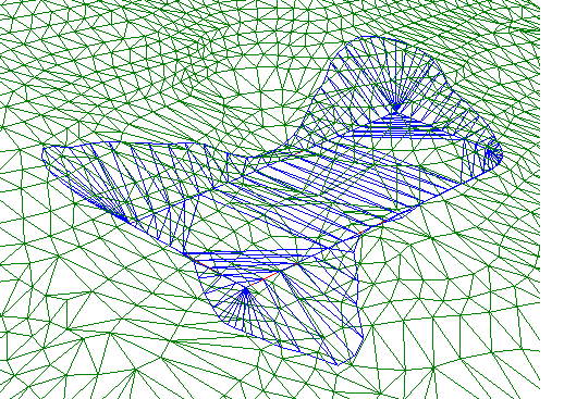
Intersection volume calculated from two triangulated networks that intersect each other
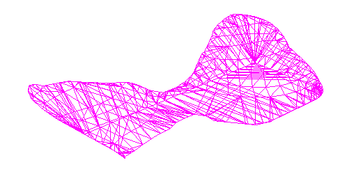
After calculation, you get an exact volume triangulated network
Combined Surface
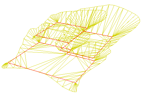
In this example, we have three triangulated networks with different base elevations (marked with a red polygon), and all base surfaces have side surfaces that intersect with the terrain.
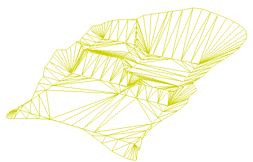
After calculation, you get a new combined surface for the lowest level.
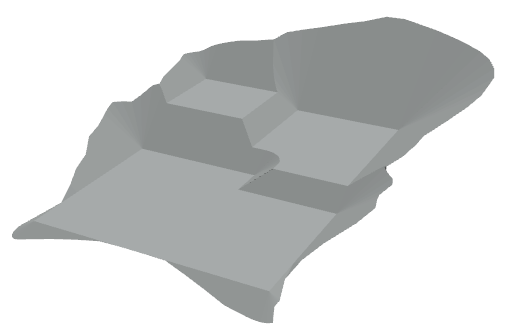
Rendered result
Note
Note that only the result is placed on the result application layer. The calculation setup itself is not saved.
Priority in Volume Calculation
A typical example is when a surveyed layer only covers parts of the area, while another layer covers the entire area. By giving the surveyed layer higher priority, it will be used where data exists, while the other layer is used in areas without measurements.
A project may contain:
- Two rock layers
- Two soil layers
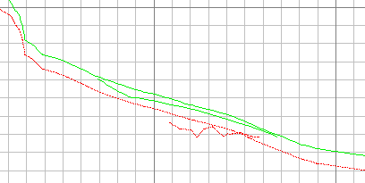
One rock and one soil layer may be surveyed, but do not cover the entire area. The other layers cover the entire area but have lower accuracy.
For volume or mass calculation, you may want to:
- use surveyed data where it exists
- use other layers as fallback in the rest of the area.
The result can be verified in:
- Quick Section
- 3D view
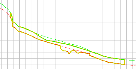
This function makes it easier to combine datasets with different quality and coverage in volume and mass calculations.